This article is a small explanation on what you will get out of attempting this course.
A lot of people wants to go to this course, so if you want the chance, you have do be fast. The hydrogeological course is a state of the art product.
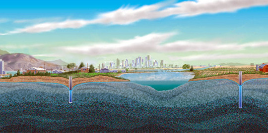
Hydrogeological modelling is a way to work with modeling of geological structures. Hydrogeological modelling is especially working with groundwater. This is what you get from working with the program GeoScene 3D. GeoScene 3D, stands for Geological Scene (in) 3 Dimensions.
This is a great opportunity for users who has experience with 3D modelling of geological areas, but also applies to users who has a little less knowledge in this area.
You will learn to hydrogeological projects, loading of files from such as wells, geophysics, seismic and so on.
Also SQL (simple queries) based on databases and setting up cross sections and cross section groups.
You will also learn point interpolation in 2D and 3D, methods of interpolation in GeoScene3D, interpolation of points to surface and using the GeoScene 3D toolbox.
When you have completed this well-designed course, you will have the skills to do geological models in the GeoScene 3D program.
These modelling skills, will make you able to create exactly the geological landscape and structures you want.
Last but not least GeoScene 3D is excelled by its ability to do the hydrogeological aspect. This is why so many is willing to take part in this course. The hydro part of this program makes you able to design and model the geological structures in the groundwater areas. You can easily make very accurate and clear structures, that is state of the art.
This is one of the absolute most hyped and best programs on the marked. In this program it makes it easier to change the structures, by reentering the program and make the corrections you need, to make the perfect geological models.
To get a better look on this you can follow the link right here.
